Ain Anub (also written Ain Aanoub, Ain Anoub or Ein Anoub; عين عنوب) is a village in the Aley District of Mount Lebanon Governorate, near Bchamoun and Choueifat. It is about 15 to 20 km by road from central Beirut and about 14 km from Rafic Hariri International Airport.
The spelling changes with the map you use. Wikipedia files it as Ain Aanoub. Canon J. T. Parfit, writing in 1917, used Ain Anub. Arabic has one spelling, عين عنوب. It is one village, and it is home to Qasr Noun, a restored heritage estate. This page is for the people who need to find it.
On the map
Ain Anub belongs to the Aley District, in Mount Lebanon Governorate. It sits on the hills south-east of Beirut, inland from the airport. OpenStreetMap places the village centre at roughly 33.786 N, 35.543 E.
The estate itself is listed on Google Maps as Qasr Noun, Wedding & Events Venue. The pin below is the gate, not the village centre, so it is the one to send guests.
Distances and drive times
| From | Road distance | Free-flow drive |
|---|---|---|
| Beirut, Martyrs' Square | 20.6 km | about 20 min |
| Achrafieh | 14.8 km | about 18 min |
| Rafic Hariri International Airport, Beirut | 14.0 km | about 14 min |
| Aley town | 7.3 km | about 9 min |
Road distances and free-flow drive times are estimates from OSRM routing on OpenStreetMap data, measured to the estate's Google Maps pin on 13 October 2026. The fastest route from central Beirut varies with the road you start on, so allow for 15 to 20 km. Free-flow means an empty road. Real times on a Saturday evening are longer. Check a live traffic map before you set off.
Treat the right-hand column as the fastest the drive can be, not what it will be.
From the airport: for guests flying in
For family flying in, the useful number is the airport. Rafic Hariri International Airport is 14 km from the estate by road, about 14 minutes on an empty road. Of the starting points above, only Aley is closer.
Flights land at all hours, and a guest who lands on the wedding day has no room for a delay. Two habits help. Ask guests who are flying in to land the day before if they can. And send them the location pin before they board, not on the night.
Directions for guests
We do not publish turn-by-turn directions here. Written directions go out of date with one closed road or one new sign, and a wrong turn on a mountain road at night costs more than a few minutes.
Guests can follow the Google Maps pin to the gate. When you arrange a visit, directions also come on WhatsApp. For a wedding, the same pin can go to every guest. One message, forwarded, is the most reliable map there is.
Parking, shuttles and the drive home
Ain Anub is a mountain village, and the roads up to it wind. That shapes the end of the evening more than the start. A few habits make the night easier, here or at any of the other venues near Beirut in the mountains.
- Name the drivers early. Agree designated drivers before the night, not during it.
- Consider a shuttle. If many guests are coming from Beirut, one coach from a single meeting point takes most of the late-night driving off the road. Agree the last departure time in advance.
- Ask how arrival works. Every venue receives cars differently. Ask where guests park and who directs them at the gate.
- Never drive after drinking. On any road, and on a mountain road most of all.
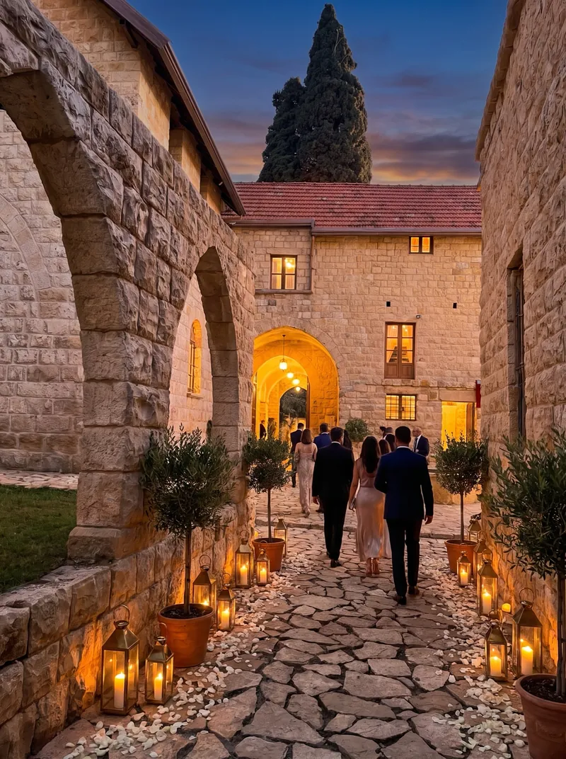
Ain Anub and its neighbours
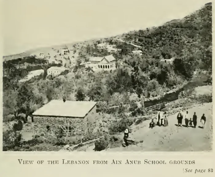
- Bchamoun is the next village. Parfit, who spelled it Beshimoon, put it “about one and a half miles from Ain Anub,” and its schoolchildren recited for the Bishop of London on the Ain Anub playground (Parfit, 1917, pp. 44 and 110).
- Souk El Gharb lies just to the east, about 4 km by road on the same OSRM routing.
- Aley, the district capital, is 7.3 km by road. It grew into a summer resort after the Beirut to Damascus railway was completed in the mid-1890s, and was for a while the summer capital of the Ottoman governors of Mount Lebanon (Wikipedia: Aley). The Bishop of London stepped off the train at “the Aley station of the Damascus Railway” on his way to Ain Anub.
- Choueifat lies to the north-west, toward the coast and the airport.
Nine miles up the mountain
The distance from Beirut is an old question here. Parfit measured it in miles and mules. An Englishwoman's furniture wagon took fourteen mules three days to haul “along the nine miles of winding roads that mount the Lebanon slopes, from Beyrout to Ain Anub” (p. 35).
A later arrival came on foot, worn out after escaping across Arabia. “It took him nearly a day and a half to drag his tired body nine miles up the mountains to Ain Anub” (p. 138).
Nine miles is about 14.5 km. The road from Martyrs' Square today runs about 20 km, some 20 minutes when it is empty. The hill has not moved. Only the time it takes to climb it has. For why this hill has a history, read the story of the Ain Anub school.
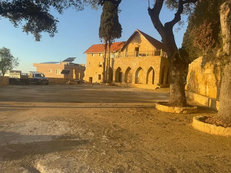
Qasr Noun in Ain Anub
The estate at the end of that road carries the date 1895 over one doorway, and became a school in 1907. It has now been restored a second time, for weddings, Katb Kteb and engagements. That is Qasr Noun in Ain Anub.
Mountain evenings run cooler than the coast in summer. For the numbers, read about cooler mountain evenings. Private visits are by appointment, and the estate is pinned on Google Maps. Plan a visit.